sshhh shh shhh… “And then it was raining and I couldn’t see or feel my to…” shh shhhhh shh
Yeesh. That crazy guy talking about biking again.
Should we just skip it?
I guess let’s give him a chance, maybe he won’t talk so much about being cold and miserable. Didn’t he want to do this???
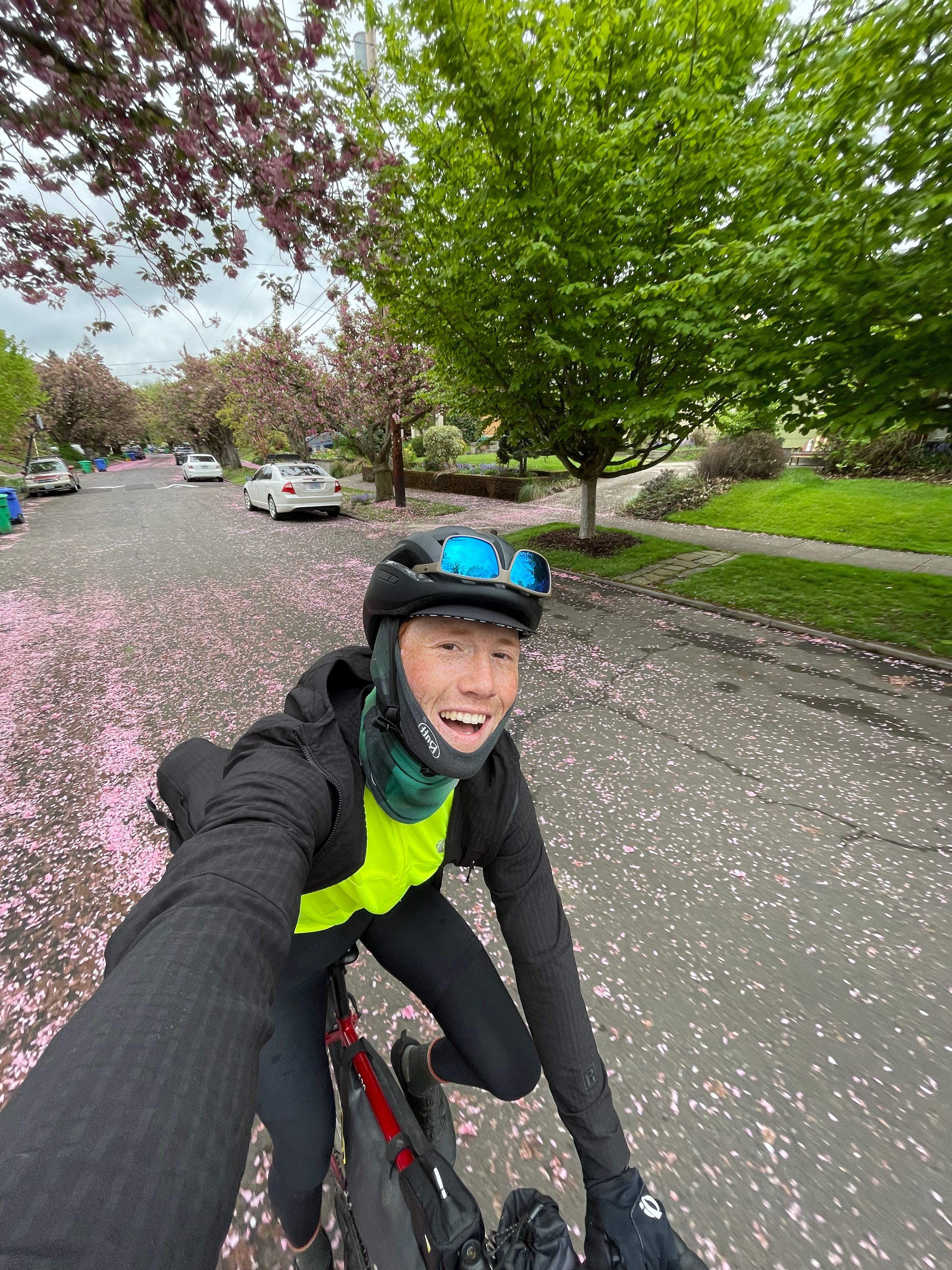
Cherry blossoms leaving Portland
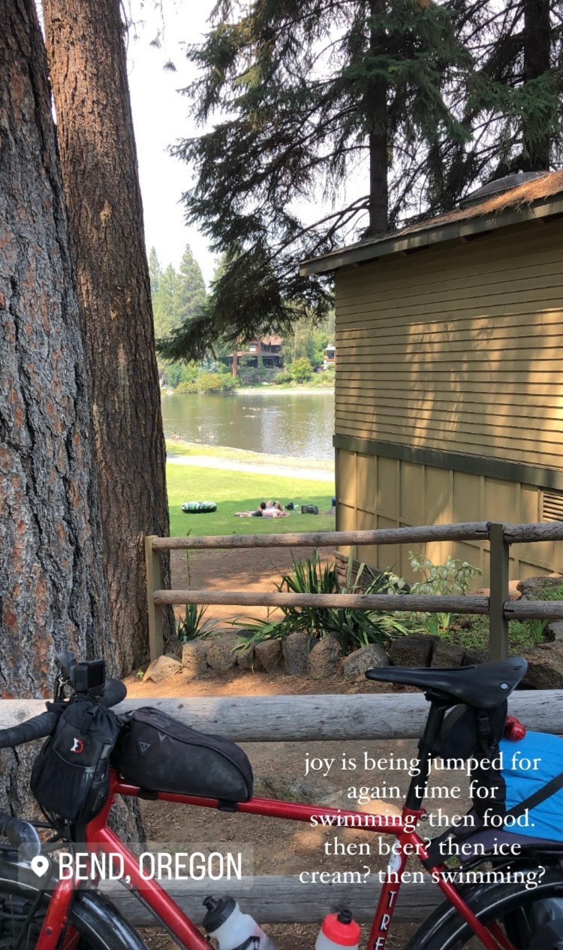
Welcome back! It’s been a while but you’ll be glad you tuned in by the time you finish. I have made it!! I successfully rolled into Bend, OR this morning, and promptly headed to the library to write to you.
Last time I was in Bend- I biked right past this park today!
It feels quite nice to be here, again, after so long since last coming through. I sat at this same library, almost the same computer (had to switch it up, you know), to write a newsletter last summer in August! Just like rolling past the park, I went past the ice cream shop where I had an all-time ice cream, and past both sandwich shops where I had truly-magnificent-life-changing-do-it-all-over-again-bike-back-to-the-same-city-to-maybe-get-another sandwich. Maybe I am crazy?
Thanks for reading Ben's Trans-Continental Thoughts! Subscribe for free to receive new posts and support my work.
1. You did it! How does it feel?
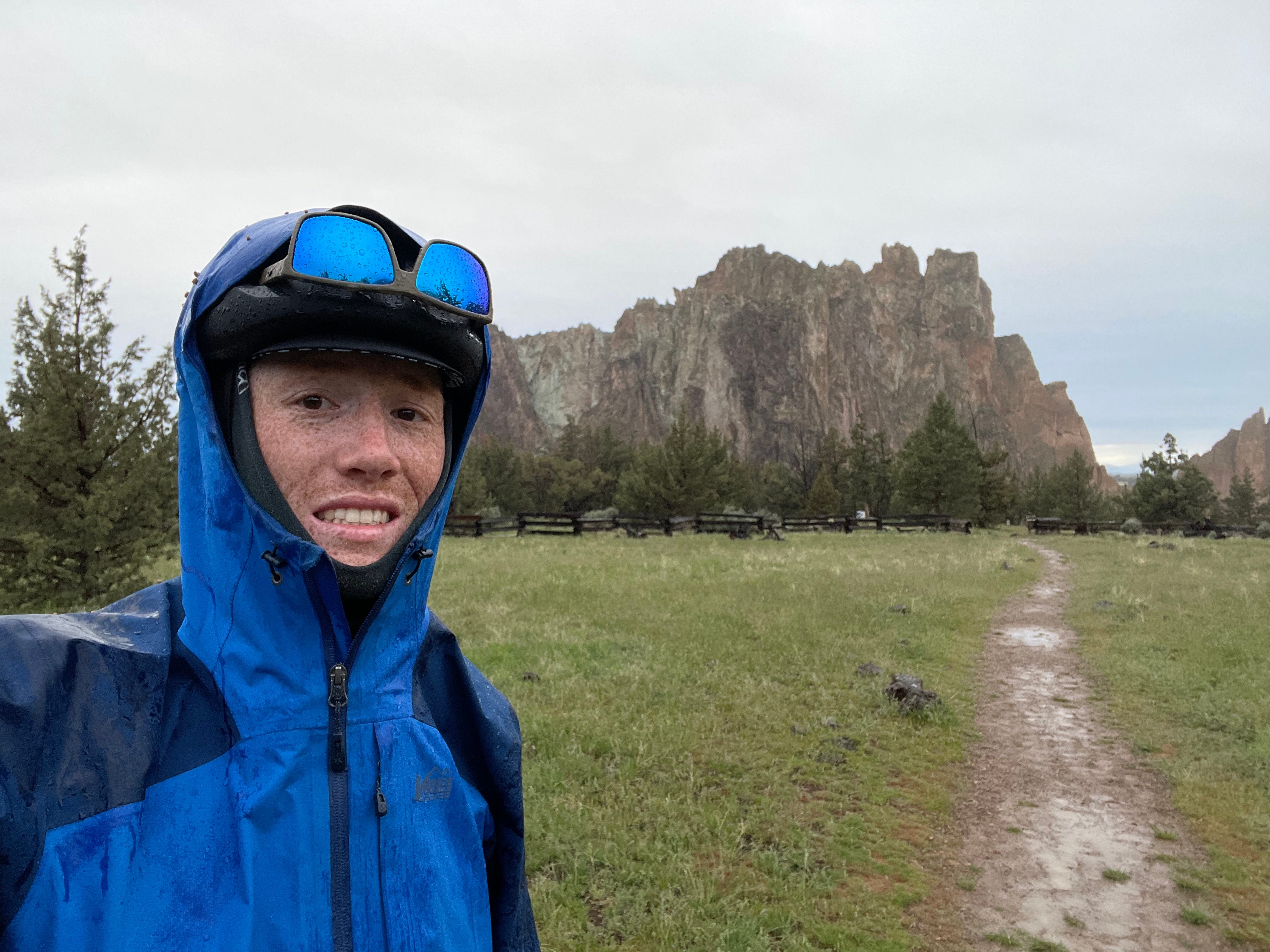
Quite awesome, but also oddly meh, to be honest. It was a beautiful day to finish and I had a wonderful rest day at Smith Rock State Park yesterday, but the day before, I had adjusted my saddle because my knee felt a bit off. This adjustment, however, was too extreme and I ended up straining my Achilles tendon. Yesterday and today have been a bit sore and aware that I now need some rest, as the days count down for the 92-mile gravel race this Sunday. It’s all about perspective though and I could be a lot worse! It’s not a bad injury and I’m done the tour, so again, the stars have aligned. No time to worry about what could have been, but to now focus on the path to recovery, showing up to the start line on Sunday in great shape, and destroying the competition!
Finishing the tour on a bittersweet note is sad! I wish I was in better condition and felt stronger, but that’s okay. I already look back fondly upon everything it took to get where I am now and I certainly am not taking all the good weather I had for granted.
Obligatory celebration pic upon arrival at Smith Rock. Had to capture the moment😅
2. Where did you end up actually going?
Thank goodness I had backup plans-on-backup plans. I feel like I have Randy Pausch and his wisdom to thank for that. Randy wrote “I admire people who are overprepared” and tells this great story about a student presenting a final presentation. When it’s the students turn to present, the projector light blows and dies. The student, calmer than ever, says “No problem” and proceeds to pull a spare project bulb out of his backpack, and proceed to complete his presentation.
I ended up making a few more changes, which I will detail below. The screenshot provides an overview of the route I took!
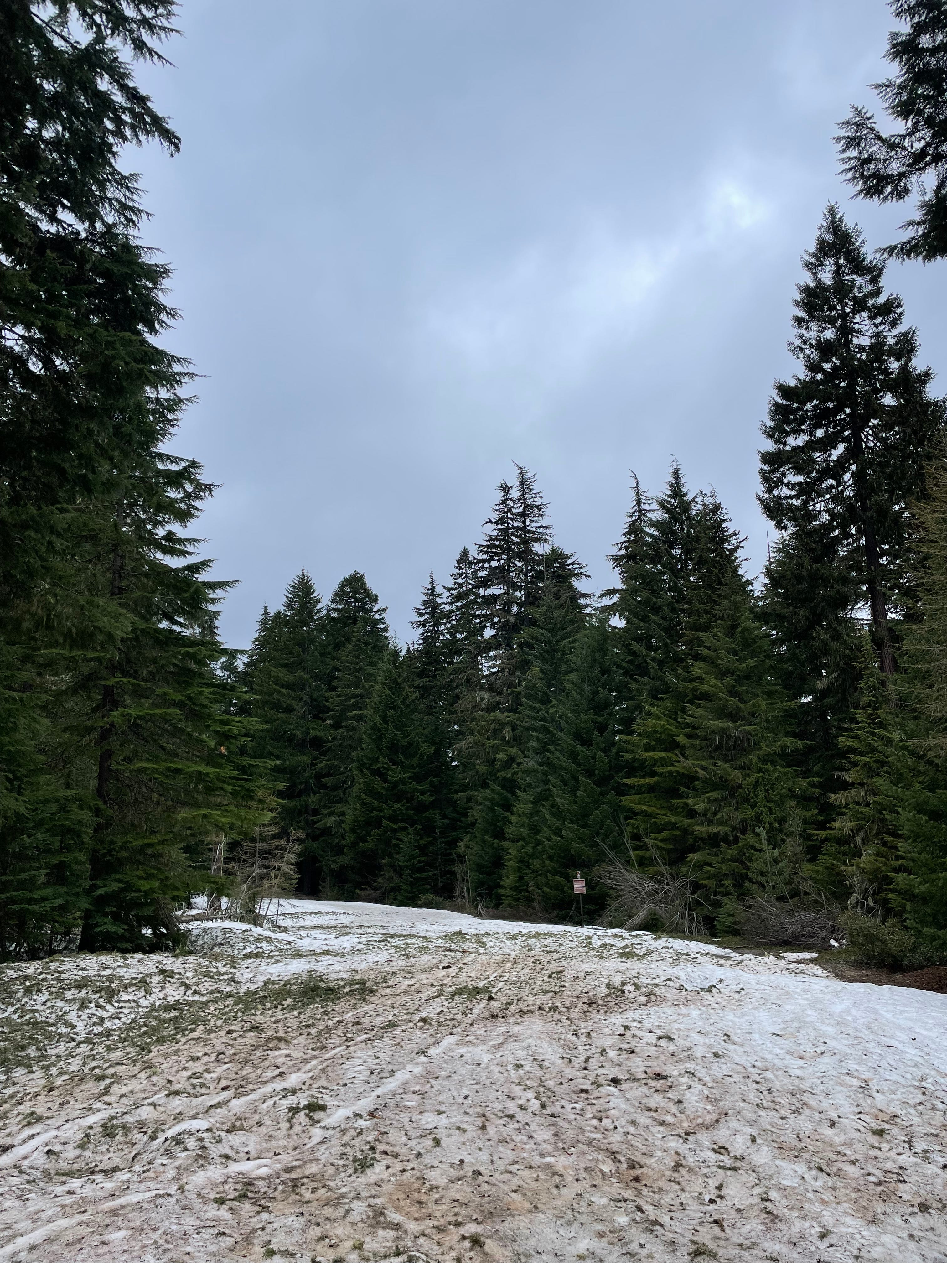
At every challenge and obstacle, I felt like I had a spare lightbulb. I knew that the roads could be impassable, but I went up Mt. Hood anyway. I had a good feeling! It turns out, the roads were most definitely not bike-able and still had snow on them. Whoops. I wouldn’t have changed it for the world though, because the view and the challenge of getting up to Mt. Hood was stunning and I’m a sucker for a big climb with a big view.
The beginning of the road I was supposed to take. @ 3800ft
This meant coming up with a new plan - and just like the lightbulb, I knew I could take an alternate paved road down a few towns over to the East and try to get on the Oregon Outback route, that would take me down to Smith Rock through Ochoco Forest.
But I’m getting ahead of myself🤠
Leaving Portland
It was tough to say goodbye to Drew and Cindy after such a lovely stay - it’s always hard to leave the warmth, safety, and security to head back into the unknown. The road was calling.
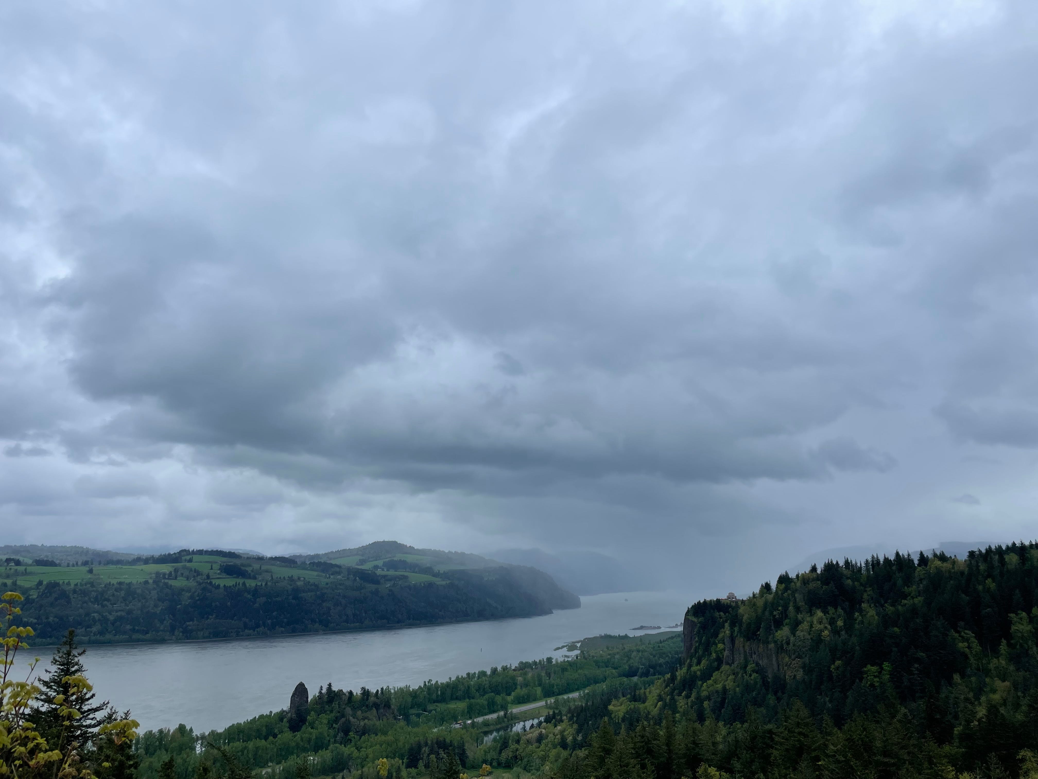
Vista Point at Crown House
Upon making it to the Columbia Gorge, I was greeted with wild views. Little did I know what the route had in store for me.
I hopped on the Historic Columbia River Highway and Trail, which meanders from the Vista Point at Crown House, down beside the Gorge, and goes for about 20 miles alongside beautiful, towering rocky bluffs, booming waterfalls, and all-around stunning scenery. I would be lying if I said I didn’t cry a bit. The whole area was truly one of the most beautiful, naturally formed pieces of land I’ve laid eyes on.
Latourell Falls. First of many!
History Time! The river spans a mile wide at times, with rocky bluffs of the canyon extending up to 4,000 feet high (1300m), and runs for about 80 miles from the confluence of the Columbia and Deschutes in the east, down to the Portland area.
Stopping and reading at many of the waterfalls and historic sites along the way, you learn that the Columbia Gorge was formed between 6 and 17 million years ago, when ancient volcanoes streamed 20 massive basalt flows into the area that’s now the Gorge. After that, the glacial Ice Age floods (Missoula floods, where I’ve also biked to, and the earths largest known floods during the last two million years), generated water flows 10 times the amount of all of Earth’s rivers. This transformed the area into one of the world’s largest concentration of waterfalls and the Columbia as we know it.
I adore history and find that bike touring and bike packing truly educate you on the land you pass through. I can no longer go over a mountain or down a hill without appreciating the time and life that had to happen for this to exist.
Cascade Locks, Bridge of the Gods. A big part of the PCT, and something Cheryl Strayed wrote about as an iconic marker. I was not too impressed, but it is a nice bridge! Don’t know which god would want it though…
Ride Up The Volcano: Mt. Hood
If there’s brunch, I’m stopping.
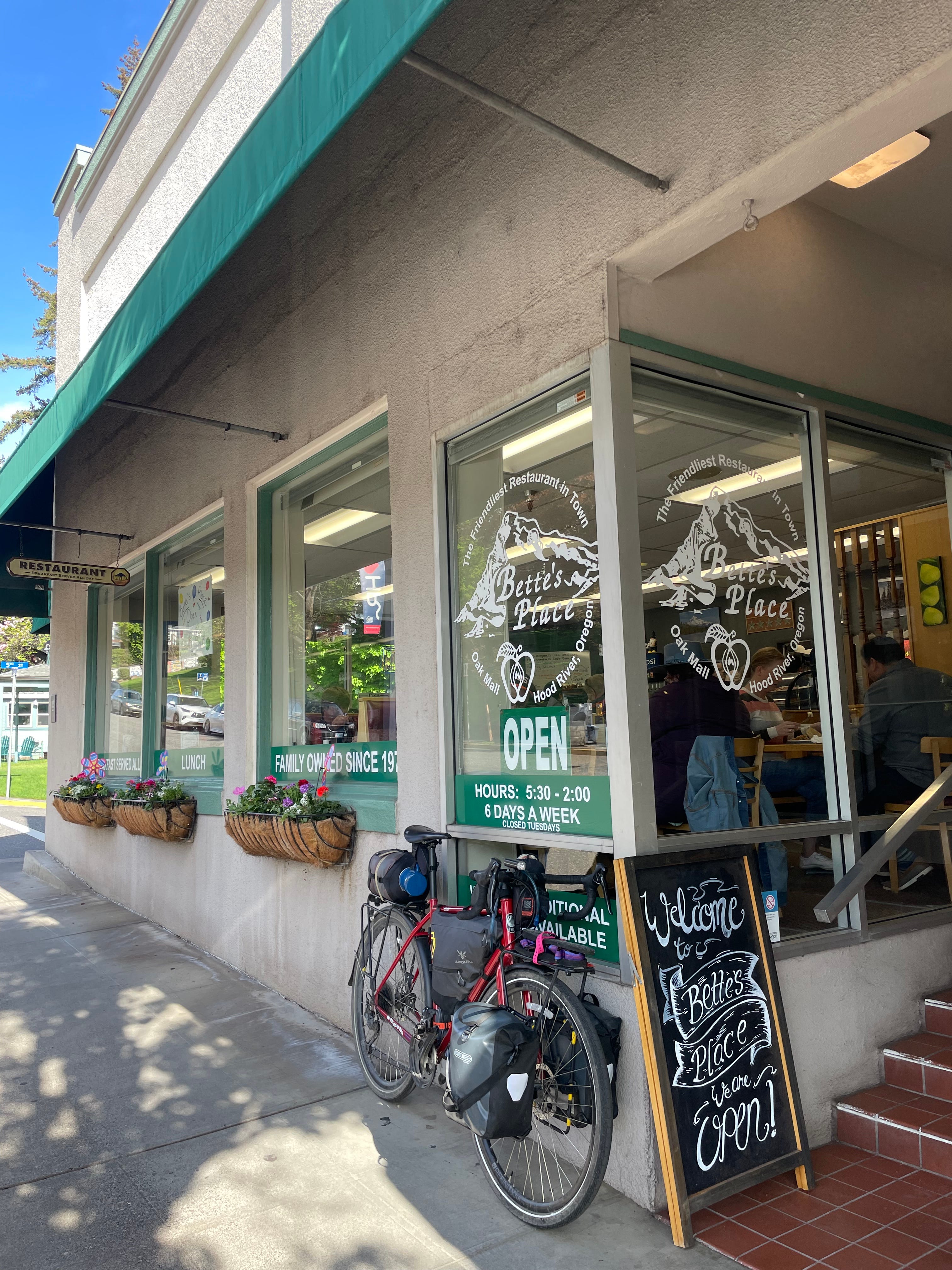
My day started wonderfully, an early morning as I knew I wanted a big brunch in Hood River before heading up the climb. The sky cleared and the sun came out - with the low clouds rolling off the side of the Gorge, the trees lighting up green and blue sky peeking through. The sun in my face as I pedaled east and again, tears formed. It’s so beautiful out here, so little to do to find a life worth living, and moments like this make all the hardship worth it. This place is magic.
I then hit Hood River, loaded up on groceries, and made my way to Bette’s Place. This was possibly the best diner brunch of my life. My god. I met my match. Like no joke, I could not finish what they served me. I gave the hostess my phone to charge, but I wish I had her take a photo of me with breakfast. A big omlette and a bigger pancake, AND I couldn’t even try their famous cinnamon rolls, which were bigger than most one-bedroom apartments in Victoria. That was a place that was hard to leave!
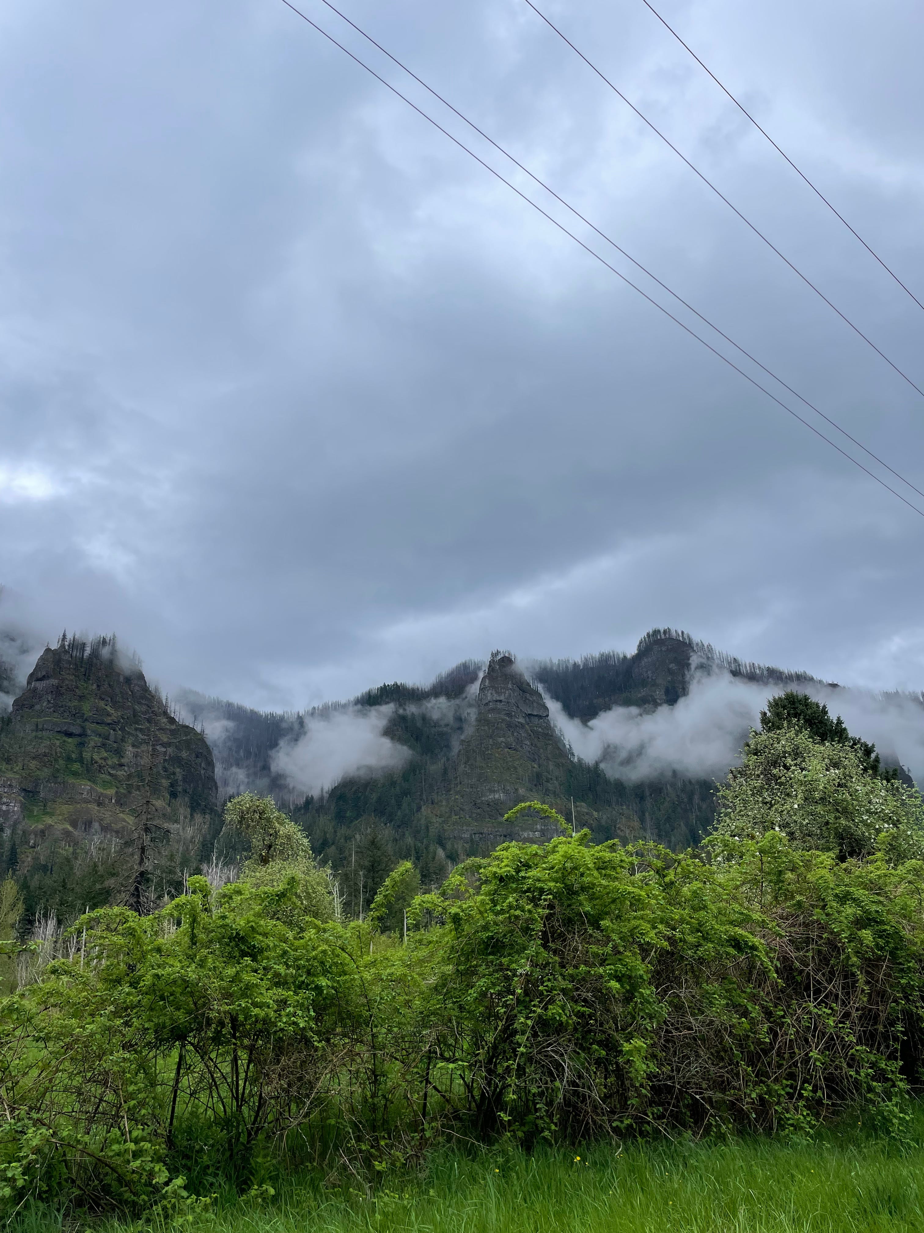
Mt. Hood National Forest with the most picteuresque scenery
I began the climb up Mt. Hood, which took ages. It was a long, and slow burn, and the elevation I think got to me a bit. Even though I started out with a great meal and coffee, I didn’t fuel very well on the way up and once I hit that 3,000ft mark I was feeling a bit lead-like. Oh well, low and slow and keep on crushing!
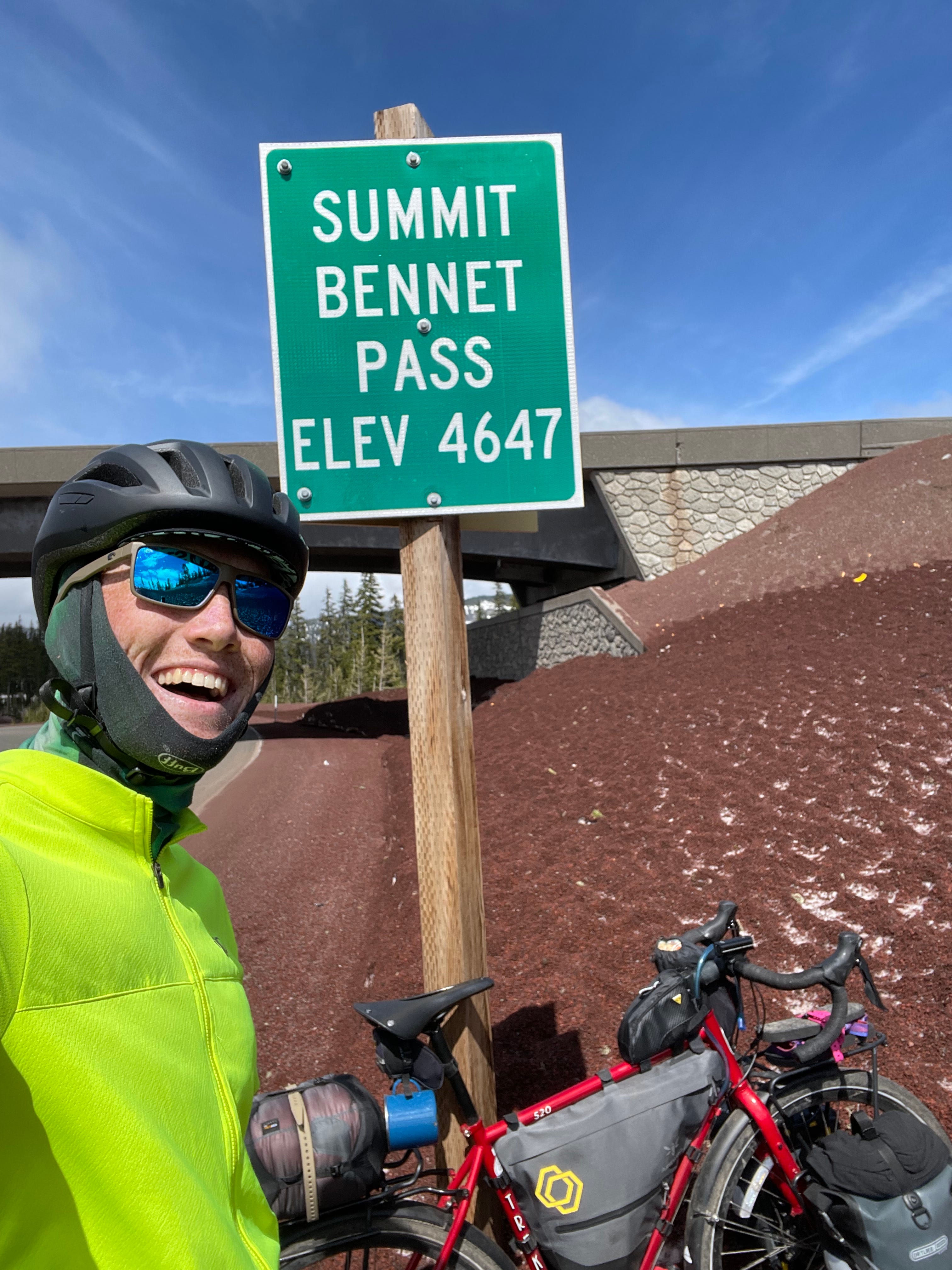
Hitting that “Pass elevation” sign is a feeling like no other, and then turning around, and getting my FIRST glimpse of the Hood peak? Chills. My jaw dropped and I just started hooting! Woohoo! I made it
Across from the sign
I pedaled on to stop for lunch at a sno-park near the top, where I could stretch out on a rock and eat lunch while stomping around the snow in my sandals.
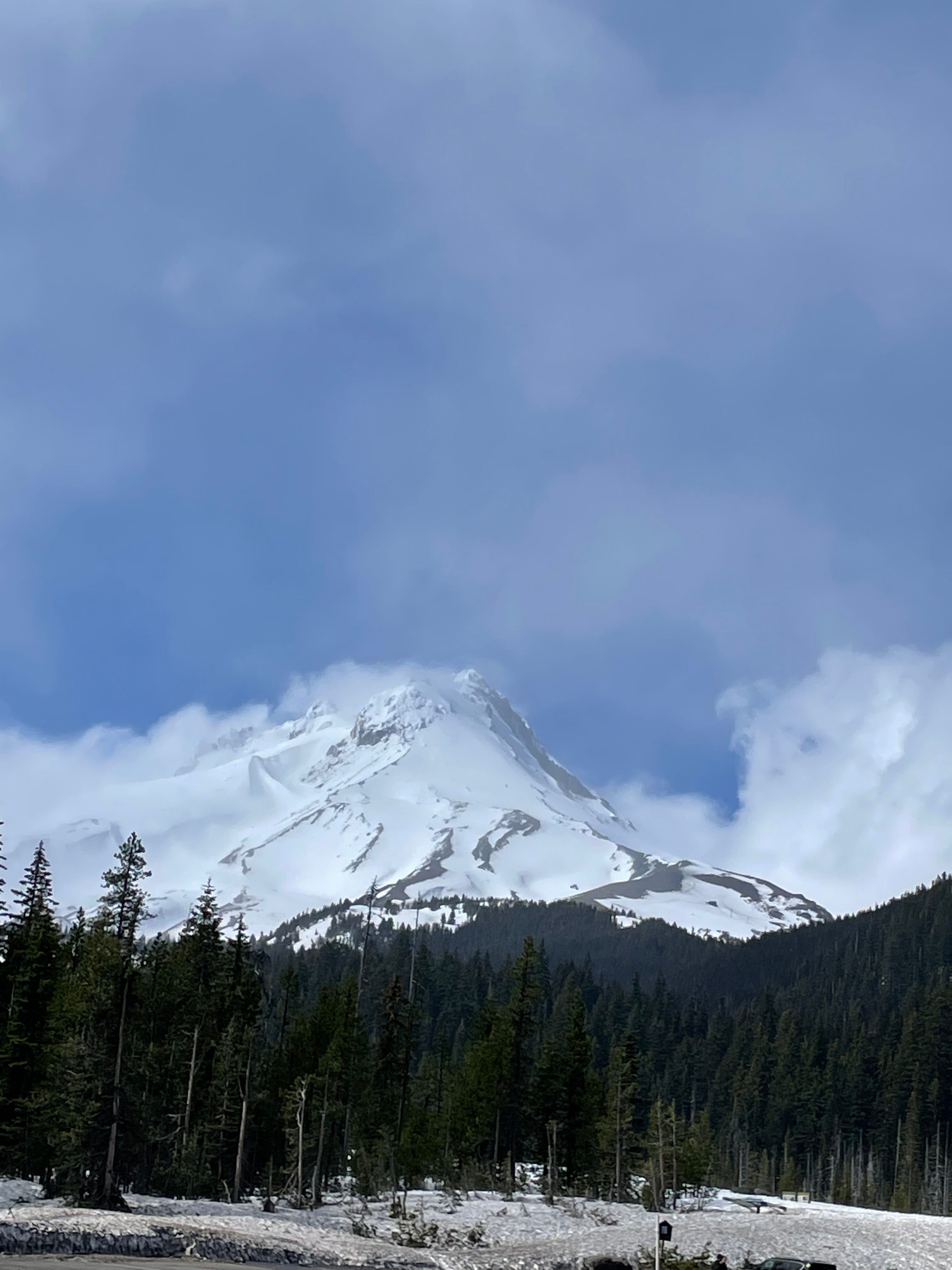
Love a good volcano🌋
I’ve decided Teva’s are like singlespeed- always good enough, but never the right gear. Loving them though!
Goodness I just love a wild adventure. Biiiig snowbanks!
My favorite was someone asking me if this was good for sledding. I looked around a bit and off to the steep drop offs in the distance, and recalled the signs about melting snowpack and how fast moving water below the snow could cause cave-ins. I said “It could be? But I’m not from here! Just be careful!” Mountains aren’t for messing around but hey, I’m just the guy on a bike eating salami with a spork.
I felt ready to go hit the forest roads and head south. A freezing descent that forced me to put all my layers on, and hitting some sleet/hail had me worried. As the sun crested the far side of the mountain and it started to get evening, I turned onto the road I was supposed to take for another 50-60 miles. Covered. In. Snow. Not a little bit, but at least a foot or two. Hardpack. Oh no. See picture from earlier.
It was dinner time, time to set up camp, and I was getting cold. I knew I couldn’t let myself get too worried and had to focus on what I could do in the moment.
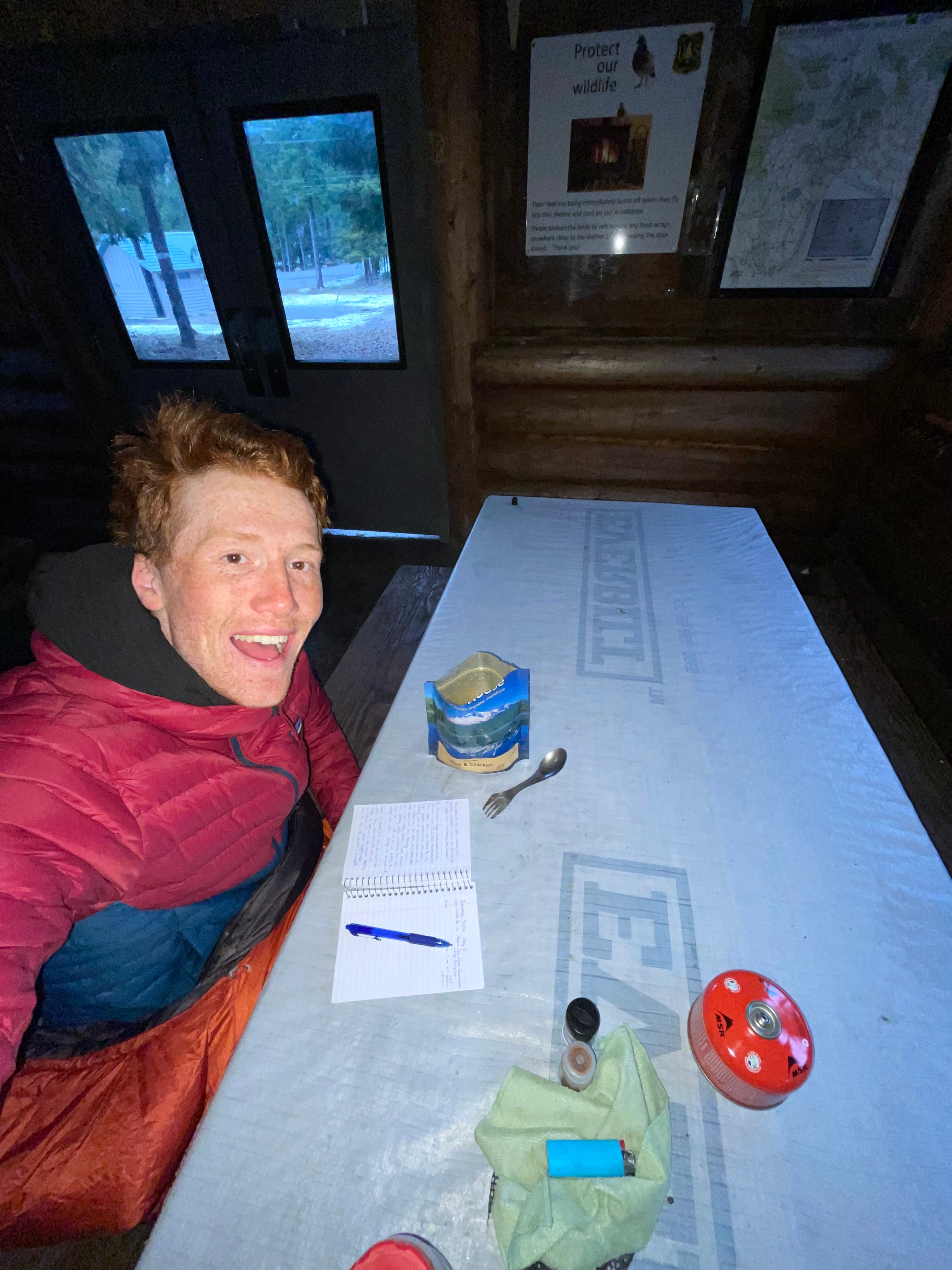
I found a big, dry, and empty snowmobile warming hut to spend the night and quickly realized I could head east out of the forest tomorrow. This would bring better weather (read: warmer fingers and toes!) and some sun, while also getting to explore new areas.
What else to do in the mountains? Eat, write, and get in your sleeping bag
The Road To Shaniko, a Modern Ghost Town
Snug like a bug
The next morning was cold. Quite cold. Not the end of the world though, because I’m always warm and cozy in my sleep setup. The winter bag (20F) and winter pad, with my baselayers and socks on, is the most comfortable I am all day!
I drag myself out to make hot oatmeal and get ready for the day. You know it’s going to be tough when your toes are cold before you even start biking.
I made like hell and decided I was going to get to the nearest gas station/town/convenience store where I could buy something hot. I was wearing almost all of my layers for the slow, but long downhill out of the mountain and the forest. Brrrr.
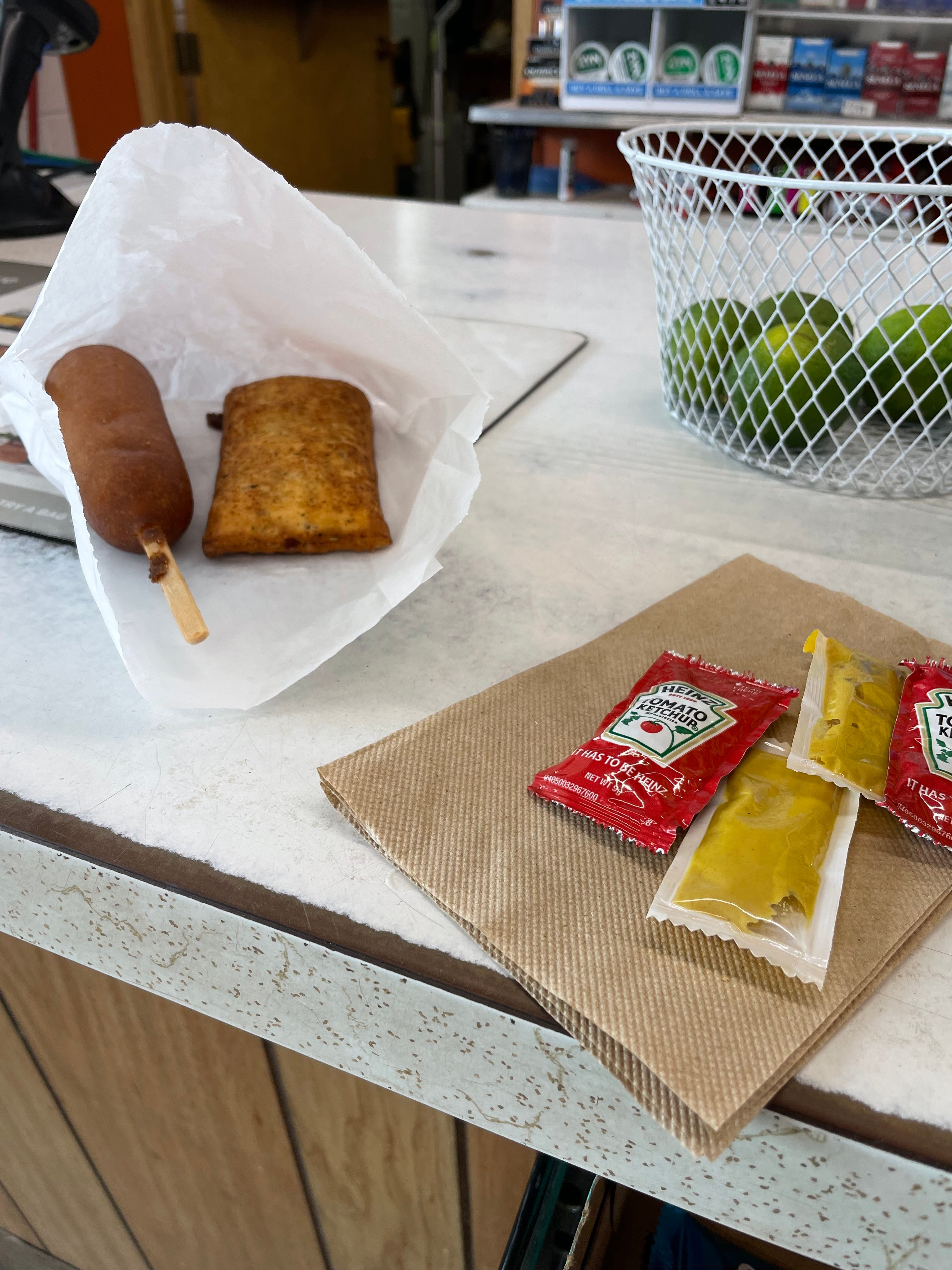
I eventually made it out and had the nicest microwaved-hot-chocolate-because-the-coffee-machine-was-broken and 10:30am corndog and pizza pocket ever.
Repeat after me: oregon-delicacy.
Crystal, the Way Station attendant, was great company and very interested in this wild person who had come out of nowhere and really wanted to run hot water through his water filter to thaw it.
I got to keep on descending towards the next town, Maupin, at the base of a very steep canyon where the Deschutes River runs through. A lovely downhill, and a steep, long uphill out of it. However, do you remember what I said about the views? Stunning.
Always somehow better when you got there on a bicycle!
The next 30 miles (a long time on a bike) was through an extremely desolate part of Oregon.
There were maybe 10 houses/farms, I counted maybe 5 or 6 cars, and when I was sitting on the side of the road for lunch, believe it or not, two cyclists rode past me and said hi! I was stunned. I thought I was hallucinating.
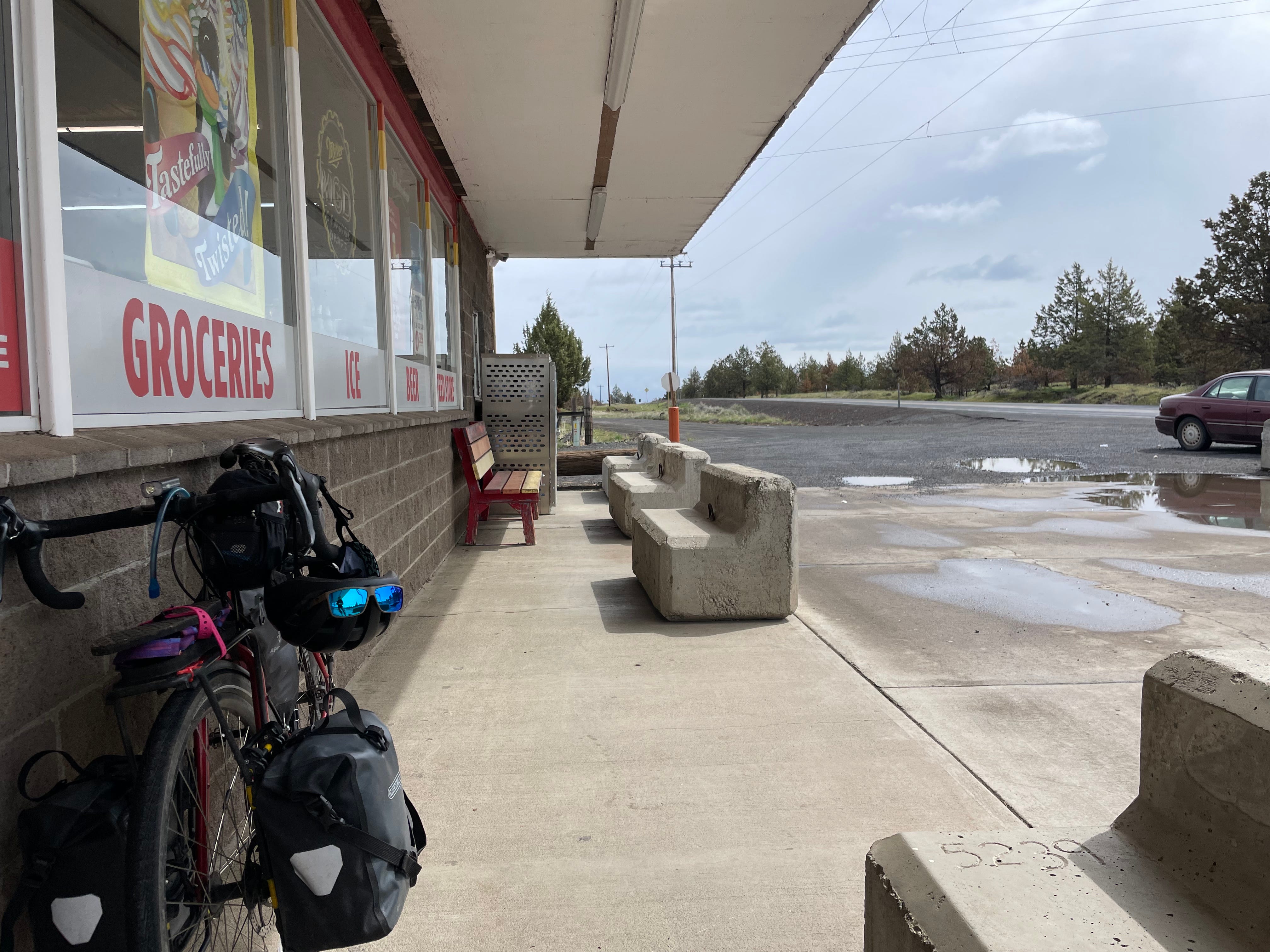
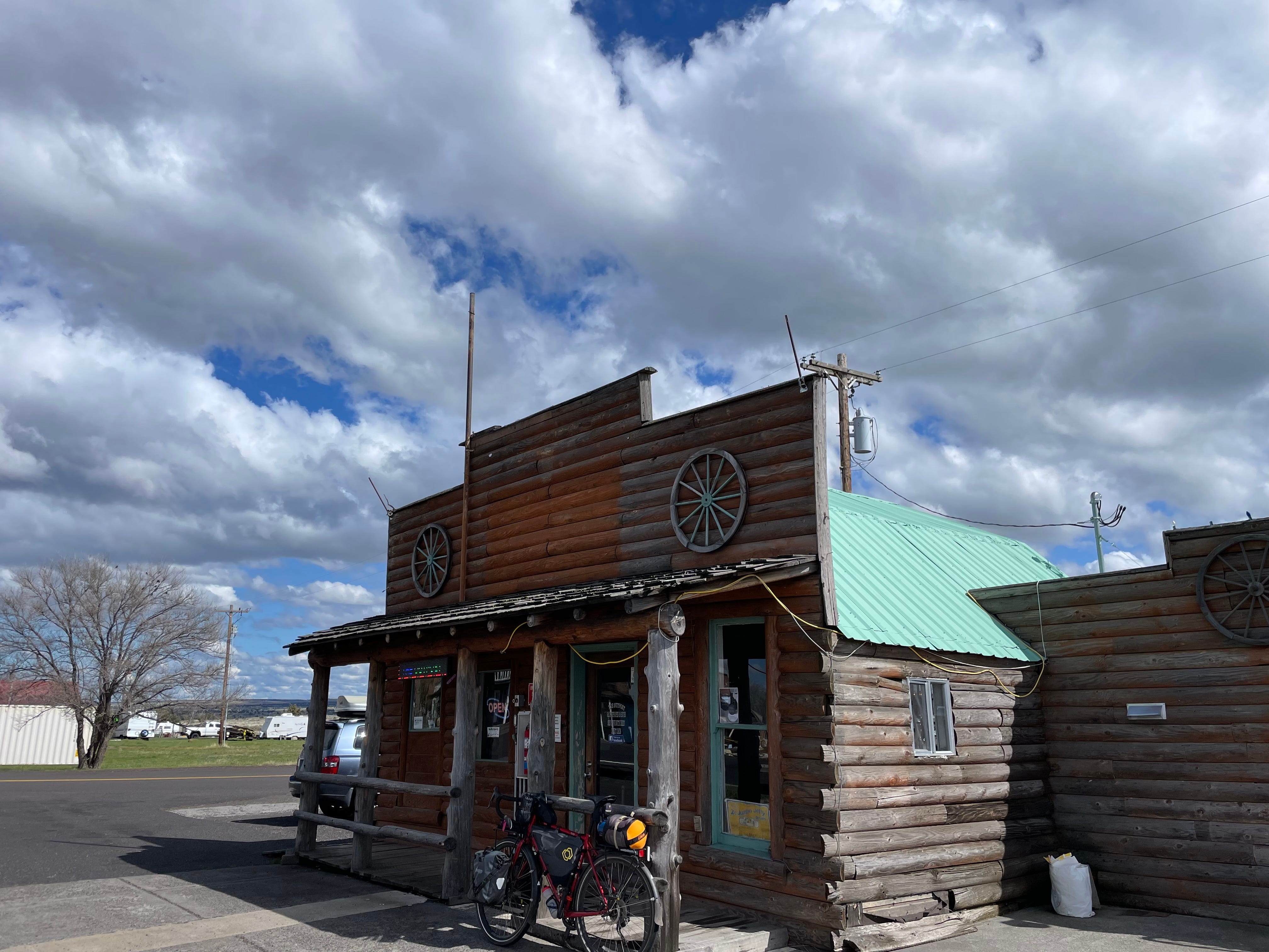
Arriving into Shaniko, the next town, was fascinating. Whenever you get somewhere small, early enough, the people are still out and willing to chat. Andrea, met me at the towns only gas station where I stopped to look at my maps.
“Gas station” may be an exaggeration. “Town” may also be an exaggeration.
She told me about how the town used to be a wool farming capital and a railroad ran through. It now has a population of 35. The town is situated on a 90-degree J-turn in the county highway. The big drama was that an 18-wheeler semi truck had run straight through the 90-degree turn. Andrea said everyone else manages to turn but for some reason he didn’t. Turns out he was asleep at the wheel and had fallen over sideways on the drivers bench.
The truck was completely swallowed by the three buildings that it plowed into. She showed all of this to me in a print-out polaroid laminated flip-book. Like what you keep family photos in. Wild. One of the buildings was the ice cream shop, which moved into the hotel. I went over for a cone.
They let people camp in their city park, where I set up and then hung out in the front lobby of their town hall, because it a) had charging outlets, b) was warm, and c) was unlocked and had comfy chairs! I read the bulletins on the wall and learned that basically one guy, Ed Martin, made the town his passion project after the sheep farming left because the railroad stopped coming through. Also, Andrea was one of three councilors (two four-year terms, one two-year term, one mayor, and one record keeper). There were 35 ballots sent out, 30 recorded votes. That is a small town. Nick, who I met in the hotel, and who came over later to say hi, told me he moved here from Seattle. Nick says there’s no traffic here (when someone is parked too far in the middle of the road, it’s a bad day) and that his vote goes much further. I bet it does Nick!
A few guys were burning down an old shed or building of some kind? I went over before bed to say hi and warm myself up by the fire. I also smelled smores I think. There were no smores. Again, maybe hallucinating. I got talking with one of the guys there, Ernie, who runs a waste management company in Eugene, OR and the greater area. Turns out his dad was Ed Martin, and he basically inherited the town. Ernie has big plans and told me to tell people about the summer music festival their having, “Shaniko Days”. He said they would have a “well-known, Central Oregon cover band”. I think we should all go and camp in the park!
Camping in the park; some of the town buildings; and the town hall with the “library” (the bulletins were all that was in)
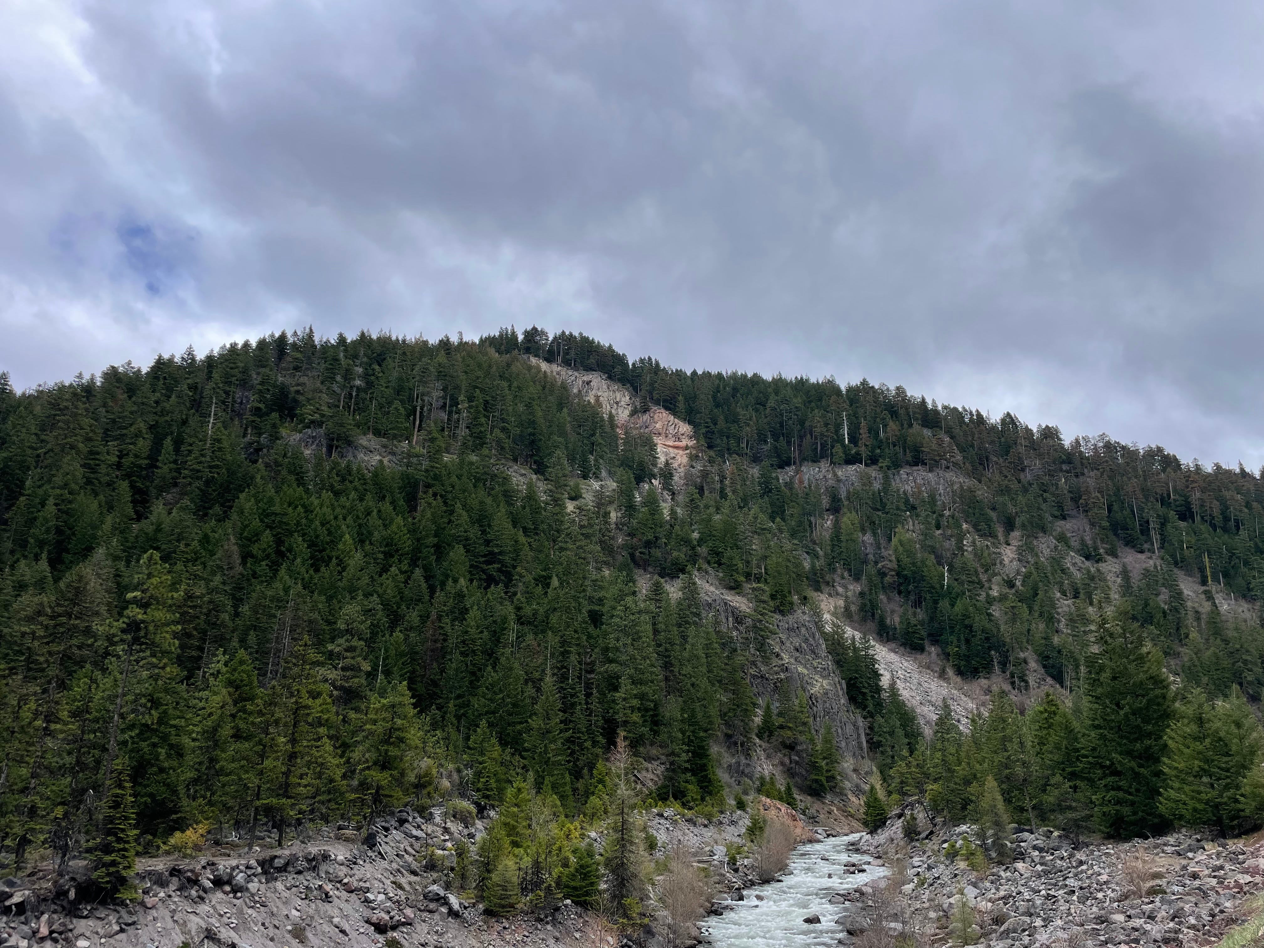
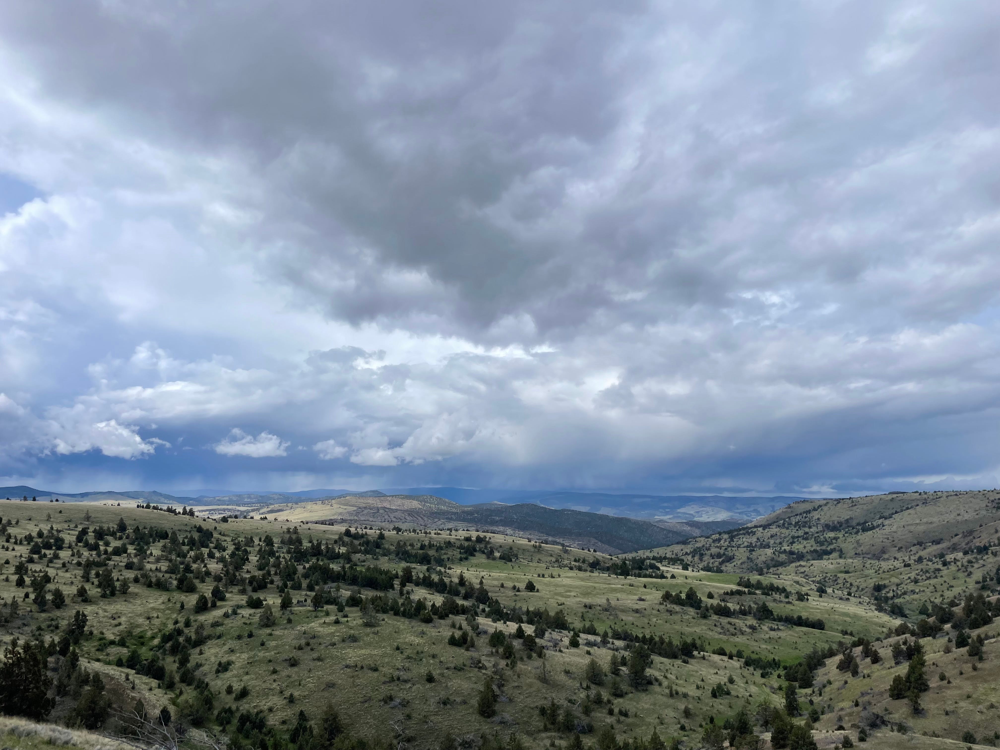
Attempting the Ochoco National Forest
The next morning I breezed out of Shaniko, hoping to get on some beautiful dirt roads and make my way south to the Ochoco National Forest and camp by “Skookum Rock”, which just sounds cool. Who wouldn’t want to camp at Skookum Rock?
However, I knew that mud could be a problem on this route and they had just received a bunch of rain. There was also 3 inches of rain forecasted today, with thunderstorms forecasted as starting around noon. Central Oregon (high-altitude desert) doesn’t get many thunderstorms. They usually start wildfires.
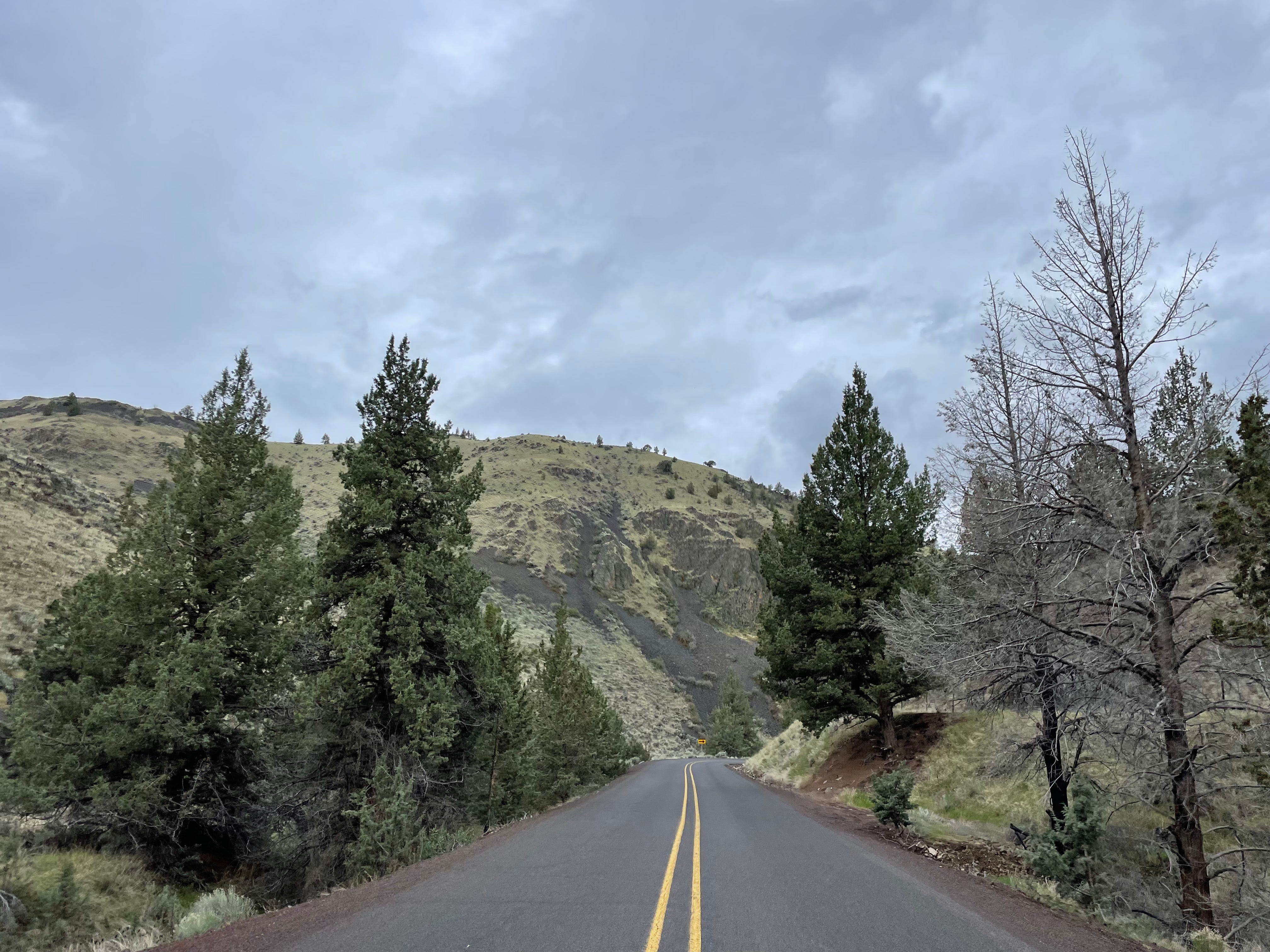
Tasty descent to Antelope
I made my way into Antelope (town, maybe 10 people live here? Smaller and more abandoned than Shaniko!) and started the dirt road. It was beautiful! Crushed gravel and hardpack, made for challening but doable riding and again- stunning views.
In retrospect, it does look like imminent weather
After turning down a hill, I hit peanut butter mud. The bad stuff. The stuff that sticks to everything, sticks some more, and then sticks even harder when you try and smear it around or god forbid, get it off. The bike would not move. I had literally traveled maybe 20-30 feet into it. The thunder cracked ahead of me and the skies began to darken. I could see rain in the distance. This was the “oh shit” moment. No time to panic, I spurred into action. I removed my front wheel to scrape mud out with rocks and my hands. It kind of just smeared, but I couldn’t accept that. Somehow I got it turning and checked the back. I noticed while it was on it’s side it, and my bags, were sinking into the mud. So was I if I stood in one spot for too long. My shoes picked up an extra 3 inches of mud and looked like mud-snowshoes. The thought of clipping in was long gone, especially after the pedal on the downside looked like mud fondue!
I shouldered my two panniers, put my bike on my shoulder and just began running back to where I could (hopefully) bike again. I stopped to put my rain jacket on, and just started pushing my bike downhill until it rolled. I rode probably 10-11 miles back into Antelope, not clipped in and a little afraid of being caught in worse weather. One lightning strike was visible and I counted it as not more than two miles away! Ozone in the air.
The sun was out in Antelope, the rain stopped and I had some lunch to calm down and come with yet again a new plan.
Smith Rock State Park, where I was headed after Skookum Rock, was only 60 miles away. Easy, I told myself, I’ll just get there tonight.
It was anything but easy.
Leaving at 12:30ish, I knew I was in for a good trek but that it was more than doable and would ultimately be so worth it, to roll into view of the majestic rock.
I hit my first hiccup when my achilles heel/tendon started to feel strained. I quickly lowered my saddle and hoped I hadn’t started a problem I could no longer fix
It is hard to miserable when it’s so pretty though!
Then the rain started. Rain jacket and rain gloves on, I had no choice but to keep pedaling. I was on a major highway in the middle of nowhere. No cover. I read a lovely text from my mother, who said she was proud of me and thought this was yet another crazy adventure that she couldn’t believe I was on or what I would do after. At the beginning of another hill to climb, unable to feel my toes, snot running down my face and a bit cold, I smiled and knew I could keep going.
I made it Madras, a town of 8,000. Excited, because this meant I could stop to eat something hot, change into dry socks, charge my phone, and warm up.
I found a top-reviewed Mexican restaurant and had a $17 chimichanga that solved all my problems. It was now 5pm and I had 24 miles to go.
I started back out in good spirits. Those ended quickly. My bum hurt, the rain started again, I was a bit cold and miserable, and my toes, of course, got cold. “This sucks.” I thought. “Woe is me. Why am I doing this. What a loser I am. Hurt, cold, sad, lonely, still far from a campground, no shower, no friends in sight. Look at all these people driving by me in cars. So smart. Who even wants to ride a bicycle? What a silly invention. I would sell my soul to get a ride from anyone passing by.“
Still pretty, in a moody way.
This, is not the self-talk that one aspires for when looking to accomplish hard things. I knew I was throwing a pity party and needed to stop. Cue playing the sing-along songs and telling myself “It’s only 15 songs away!”. You know it’s tough when you have to count distance in songs.
Smith Rock
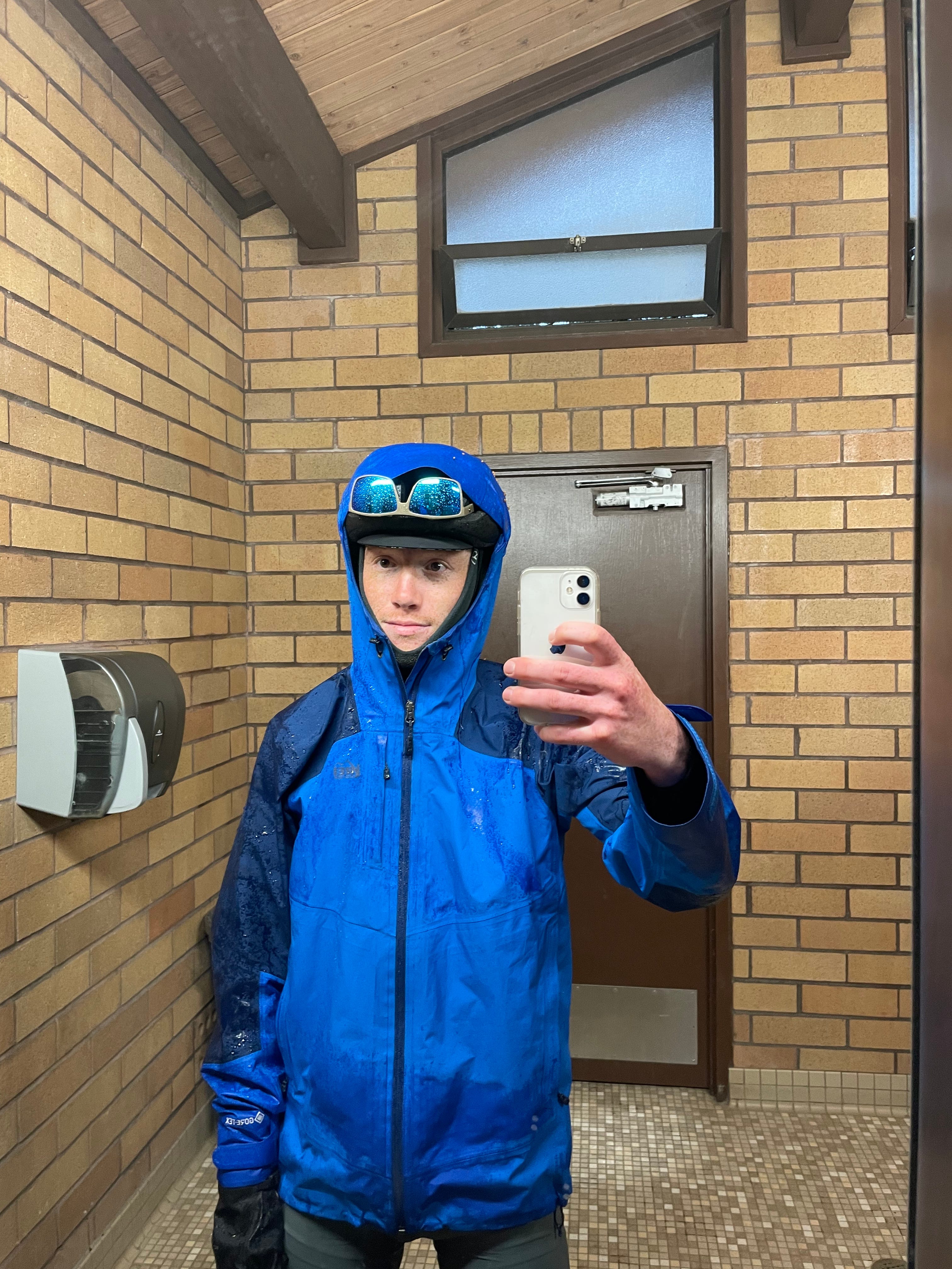
I arrived at Smith Rock, a sopping mess and a sorry excuse for a person. See picture above
Very apathetic, I had a weird half smile as I trudged around the campground, looking for where I could sleep. Even the rock climbers looked at me like I was a black cloud. I leaned my bike up against the trees in my site, and walked over to take a victory picture with the rock. Silly rock, I thought. It wasn’t even that cool. Why was I here?
I forced myself to go see the bathrooms and if they had showers.
My luck changed. Immediately. Absolutely. Unequivocally flipped on a dime. Not only did they have showers, but they were free and HOT! Woohoo!! Warm toes and fingers here I come!
In the pouring rain, numb fingers and toes, I set up my tent in about one minute and put my sleeping kit inside, to deal with later. The showers shut off at 8pm, in about 12 minutes. I ran with all my bags, muddy and soaked, to the showers. I got that shower for it’s life, for 10 whole minutes. It wasn’t particularly great, or hot, but it was better than anything else in the whole world at that moment. I put all my dry clothes on, warm and cozy. I walked back out to my campsite, on top of the world. A huge smile plastered on my face and knew that I would do it all over again if I had to. I had made it.
I set up my sleeping bag and pad while the rain came down outside, and then made a victory ramen dinner in the vestibule of my rain fly.
Love a good vestibule dinner!
All while sitting, tucked into my sleeping bag, warm and dry. I ate it in the dark, still listening to the rain. I wasn’t worried about anything except enjoying the present and looking forward to the biblical sleep I was going to have.
End of a Chapter
The total distance of the tour counts at 630ish miles with 38,000 ft of elevation gain, or a little over 1,000km and 11,500m of elevation gain. It took 12 days, counting two rest days, through two states, one national park, two national forests, and a handful of state parks.
My library computer time is running out, I’m hungry, and it’s time to roll over to Rob and Christina’s. I’ll finish the stories later and I’m looking forward to rest and relaxation before this race on Sunday. I hope you enjoyed the wonders of Central Oregon, told and experienced through my eyes, and I do hope I didn’t complain enough to turn you away from future editions.
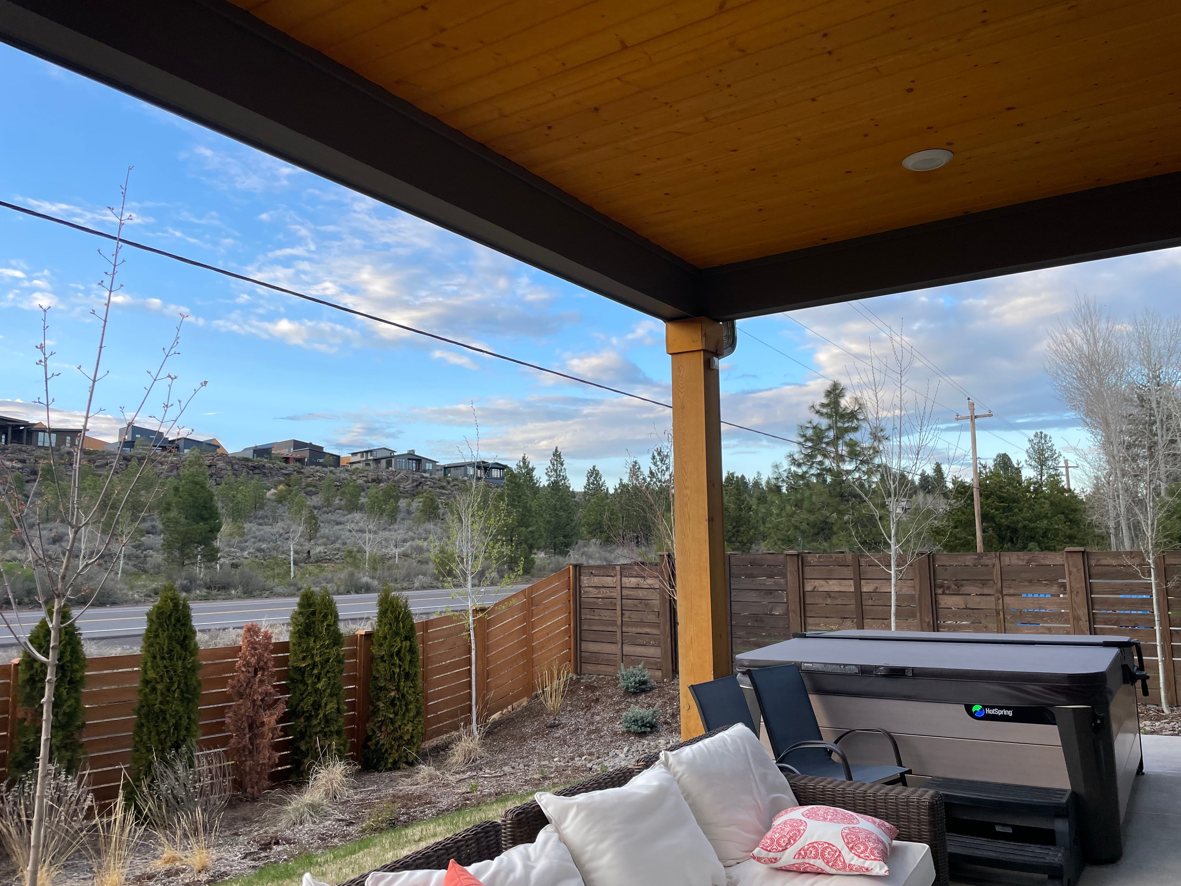
Best place and best people to do some healing!
The ride into Bend this morning was tough. Beautiful weather and a hurt achilles tendon were quite the contrast. You can do anything for 30 miles, I told myself. Charlie and Shawn, the thru-hikers, loved that line. I like it too.
Tons of love,
Ben Stevens
** P.S. - if you’re reading and you see the “I’m cold” or “I’m hungry” and make the “Hi ____, I’m ____ (Dad, usually), I’m glad. I make these jokes to myself all the time when I complain and it never fails to put a silly smile on my face. I hope it does for you too!**
Bonus pics!
(don’t) Love carrying my bike down stairs
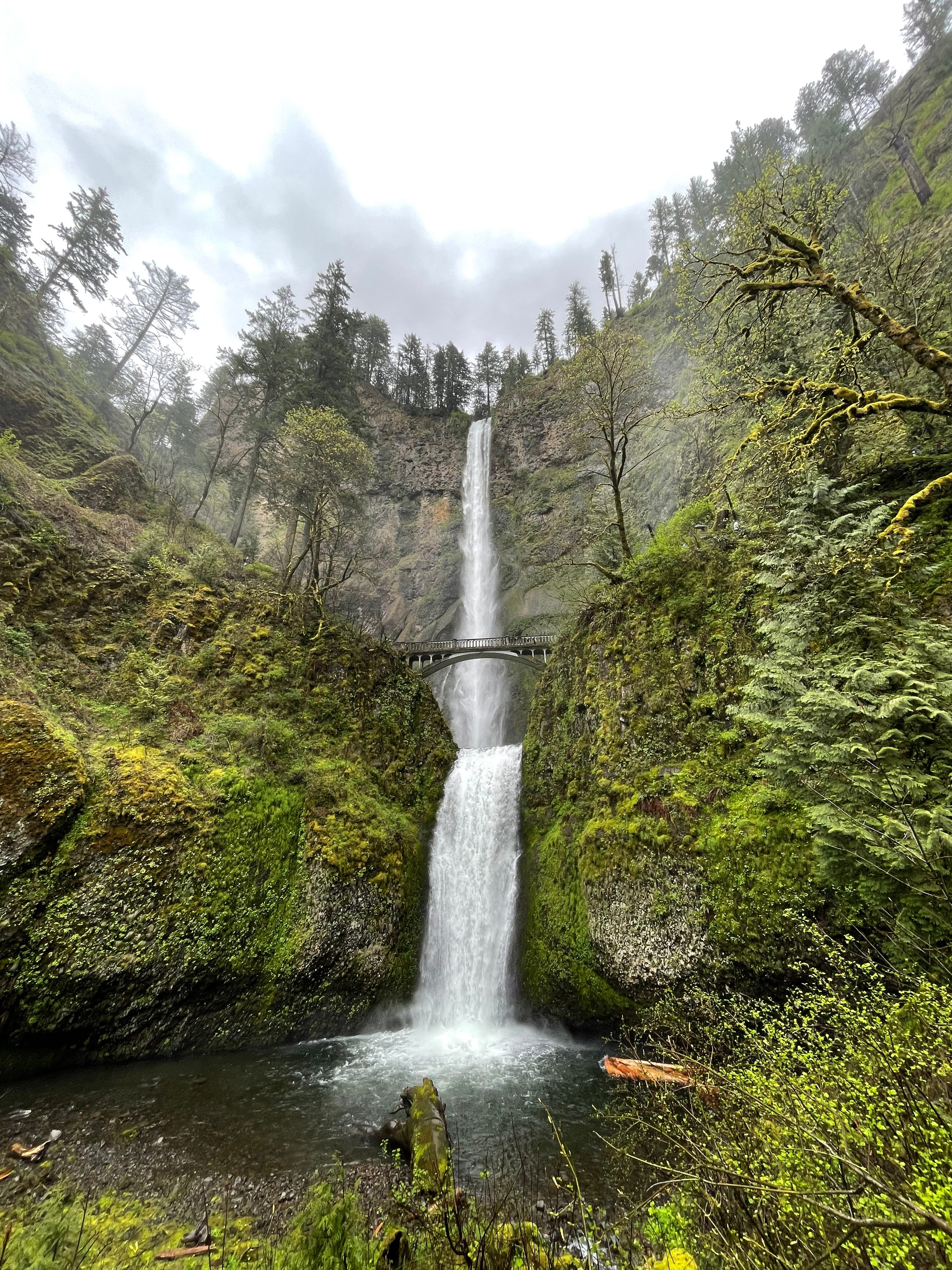
U.S.’ second-tallest year-round waterfall! I have so many waterfall pictures…
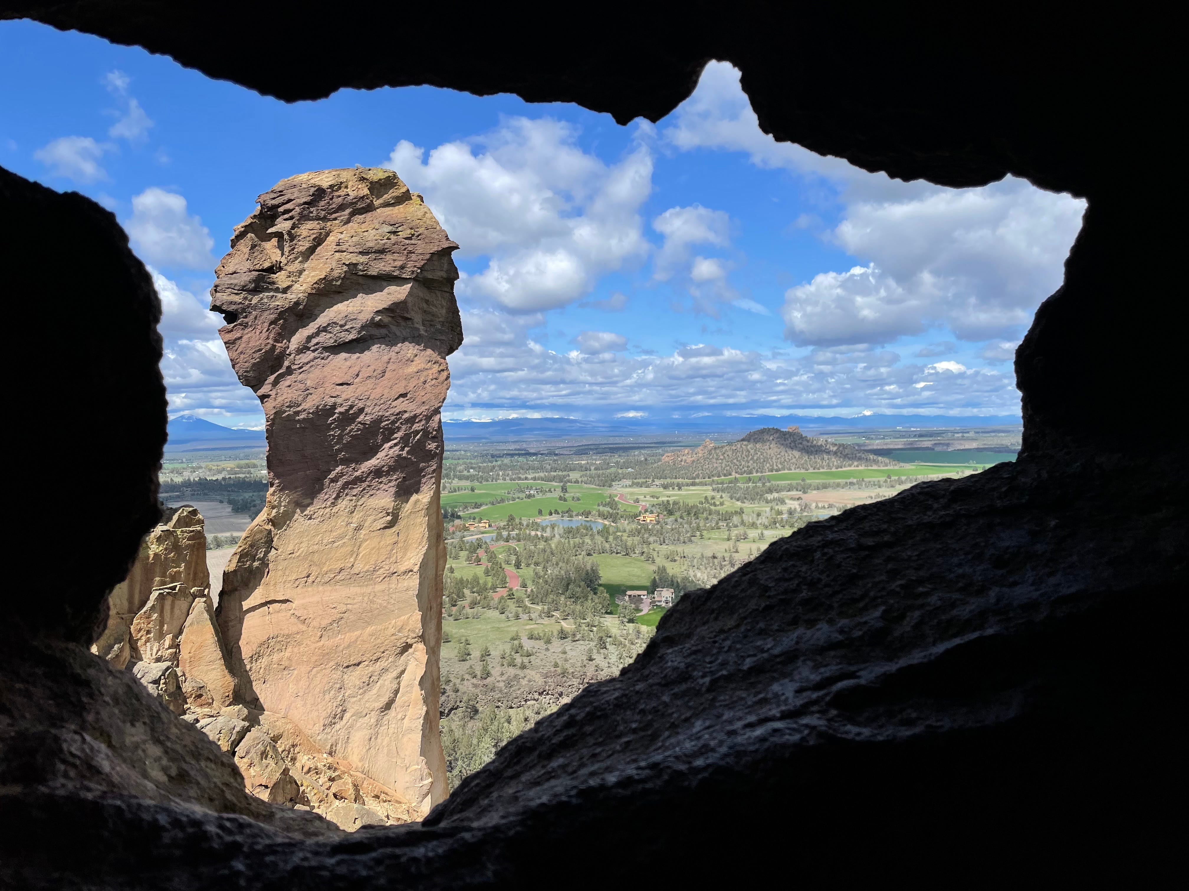
Sneak peek of Smith Rock adventure🤫
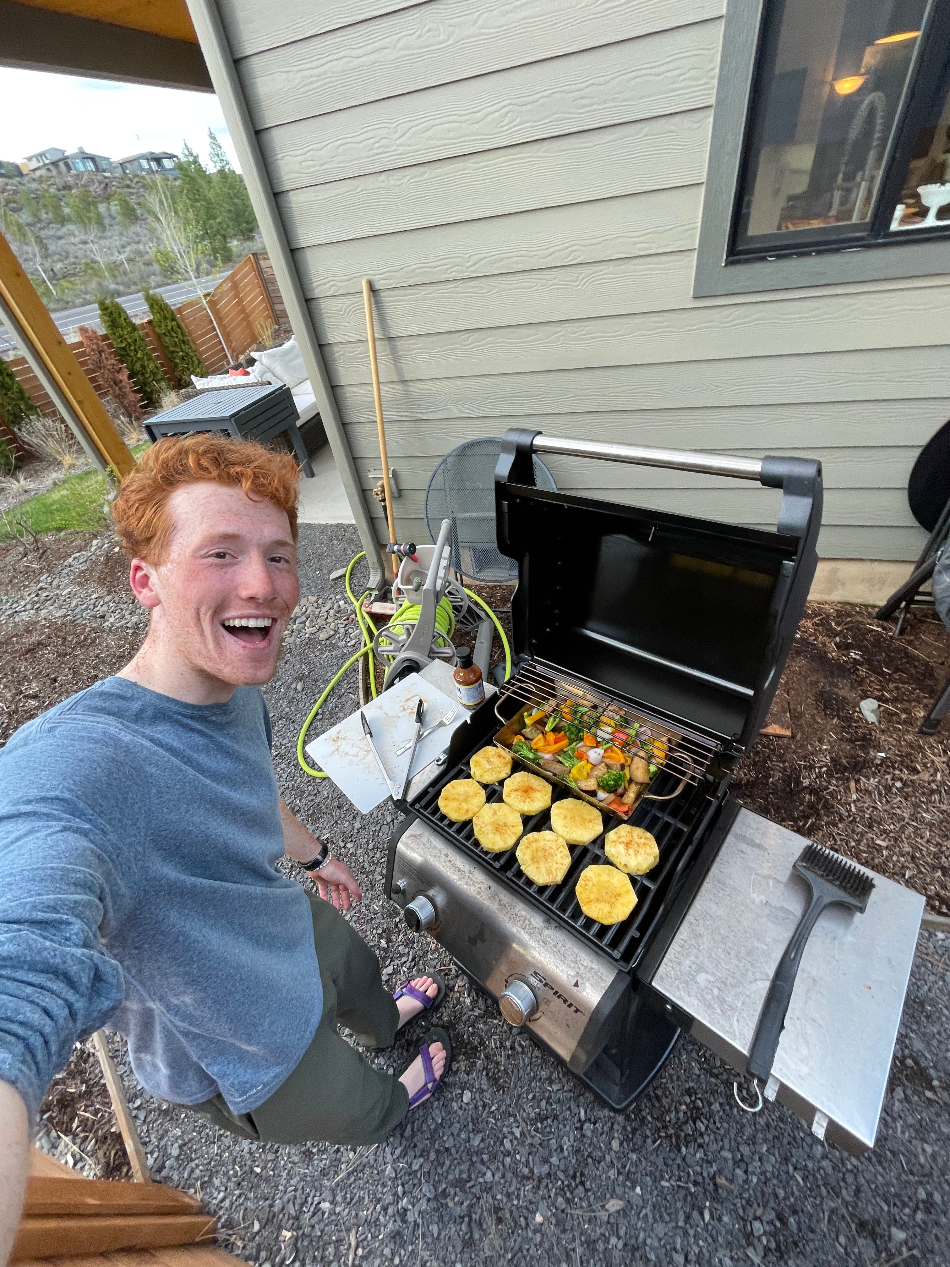
Introducing Rob and Christina to grilled pineapple!
Thanks for reading Ben's Trans-Continental Thoughts! Subscribe for free to receive new posts and support my work.